Routeways cut into the landscape
Holloways, or sunken lanes, are created by the passage of people and their carts, aided by the erosive power of rainwater as it washes down the ruts. They are most common and prominent on slopes in areas of soft rock.
Holloways are a very common feature on the Hamstone of South Somerset, and photo 1 shows one that is aligned to the gatehouse of Montacute Priory, founded between 1078 and 1102. Use of this track declined following the dissolution of the priory in 1539, but after 1776 it was re-used by the Phelips family as a carriageway to the tower that had they built overlooking their Montacute estate.
Nearby, is a deeper holloway (photo 2) that is part of a Roman road between the eastern entrance of Ham Hill Iron Age hillfort and the nearby Roman town of Ilchester. Located on a steep slope, almost 2000 years of traffic had cut deeply into the rock before the road received its modern tarmac surface.
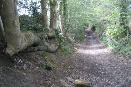
Dark Lane in Derbyshire (photo 3) has cut down through a band of mudstone and shale within the harder Millstone Grit. Mary Queen of Scots reputedly came this way when being moved from Wingfield Manor to Tutbury Castle in neighbouring Staffordshire.
Further information
What are sunken lanes? (National Trust)