Saturday 19th and Sunday 20th September 2026
SLS conference at Hartington
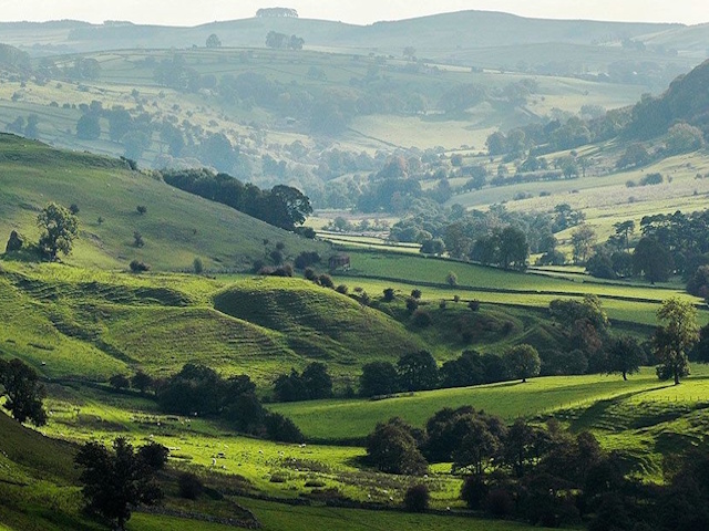
The Society for Landscape Studies is pleased to offer a conference concerned with this fantastic landscape, looking deep into its past as well as some of the challenges for the future. The conference is being brought to you in collaboration with the Tudor Farming Interpretation Group, who have been working around the River Dove on one of the most complete records of environmental change in an upland fringe landscape in the British Isles; we shall be looking at how this landscape has developed from the prehistoric period, using the results of pollen analysis, OSL dating of earthwork features, documentary research and landscape survey. This work is hugely relevant to our understanding of environmental and social change both locally and nationally, and also very timely in view of the fact that the Archaeological Research Framework for the Peak District National Park will be undertaken this year.
We shall be based at Hartington Village Hall, which is sited close to the magnificent parish church. Hartington is a beautiful village with pubs, cafes and accommodation including a Youth Hostel at Hartington Hall, converted from a fine late medieval and 17th century manor house – see https://www.yha.org.uk/hostel. Parking shall be available opposite the hostel on the Saturday, and we are arranging a conference dunner for those who would like to come on Saturday evening.
The nearest railway stations are Buxton and Macclesfield. There is a regular bus (the 422, see https://portal.highpeakbuses.com) between from Buxton which stops at Hartington.
SATURDAY TIMETABLE
Location Hartington Village Hall, Hide Lane, Hartington, Buxton SK17 0AP
9.30 Village Hall open, tea and coffee on arrival
10.00 Welcome
10.15 Introducing the Peak District, Ken Smith Former Chair of Peak District National Park Authority
An introduction to the historic landscapes of the Peak District, reflecting the understandings that have been achieved through decades of landscape survey, both above ground and below. When combined with the extensive historic map evidence for some Peak District estates, which informed landscape character assessment, this has resulted, for example, in a particularly well-informed understanding of landscape development over the last three centuries, in particular the impact of the enclosure movement.
11.00 New Directions in Research Anna Badcock, Landscape & Conservation Team Manager, Peak District National Park
National Park landscapes have always evolved, but is change picking up pace in the light of climate adaptation and landscape-scale nature recovery ambitions? This talk shall highlight some findings from current projects and show how we are responding to these challenges in different ways. I shall discuss results from our emerging Archaeological Research Framework, including newly identified gaps in knowledge and our experimental attempt to map research questions. I shall showcase our newly catalogued archive of images that stretch back to the inception of the national park, and how these could be used for future research. I shall also show how our NLHF-funded volunteering project is helping us to gather new data, and to explore biodiversity on heritage sites.
11.40 Break
12.00 Farmsteads and Fields Jeremy Lake, Historic Buildings and Landscapes Consultant
Farmsteads and their fields tell us how farming practices have changed over centuries, with strong contrasts between areas where village-based farms worked strip fields and areas of dispersed settlement where the oldest farmsteads tend to be found. This talk shall examine how farmsteads developed from the medieval period, in relationship to these strong local differences in and how they further developed as large areas of common land were enclosed from the late 17th century and how farmers responded to the growth of industrial centres and important markets to the west and east of the Peak District.
12.40 Mapping Landscape Change in the Peak District David Alexander, Peak District National Park
The Landscape Change and Conservation with MapReader project has created the first historical digital twin of protected landscapes, focusing on the Peak District National Park (PDNP) and South Downs National Park (SDNP). This talk shall examine how the project has analysed nineteenth century and twentieth century Ordnance Survey maps provided by the National Library of Scotland to measure and quantify past landscapes, with an emphasis on built and natural environments particular to specific park landscapes.
Questions and answers
13.15: Lunch and SLS Annual General Meeting
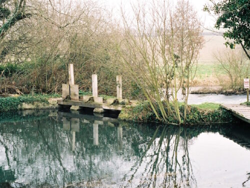
14.15 Past environments at Under Whitle Ian Parker-Heath, Project Manager & Archaeologist, Digging Deeper: A Community Archaeology Project
The Tudor Farming Interpretation Group (TFIG) have been undertaking research at Under Whitle, a small farmstead nestling in the Upper Dove Valley, since the early 2000s and Digging Deeper was their second project. Previous work by the group had found documentary evidence of occupation by two families for over 300 years and archaeological material that confirmed some of this, but there were gaps in the story. This paper will tell the story of this background work and how the astonishing results of this work came to be.
14.50 Under Pressure: The people on the edge of the Peaks Tudur Davies, Cardiff University
This paper examines the resilience of a farming community in an upland valley on the boundary of the limestone plateau and Dark Peak. It provides the results of a recent pollen study on a sampling site which is uniquely situated immediately adjacent to a ridge and furrow field system of presumed medieval date. The results provide an understanding of environmental change for a landscape context that is rarely examined, as pollen sampling sites are usually located in upland settings away from the traditional focus of arable activities and core settlement areas. This presentation provides some of the results of this analysis, focusing on the palynological evidence for the farming economy during periods of climatic and cultural change between the 7th and 15th centuries.
15.30 Tea
15.45 Medieval and post-medieval history
Andrew Sargent
This paper will focus on the evidence provided by place names and field names, illuminating the development of an upland fringe settlement and its fields from the mid-late Saxon period to the 19th century, and placing Under Whitle in the context of nearby settlements at Longnor and Sheen. The documentary evidence is particularly rich for the estate of the Harpur Crewes, enabling its tenurial history from the late 14th to the early 19th century to be traced and including a detailed survey of 1632-33. The paper will highlight the importance of piecemeal enclosure of medieval strip fields and enclosure of the valley-side and hilltop wastes and commons, creating the landscape visible today.
16.15 Researching historic landscapes with OSL profiling and dating: results at Under Whitle and its national context Sam Turner, University of Newcastle/ Luxcapta Consulting Ltd
Earthworks of all sorts have been a persistent problem for archaeologists because conventional methods for dating them are often little use. While the likely order in which boundary banks, ditches, and other features were created can often be assessed through field survey and/or excavation, their exact dates are typically very hard to establish with precision. In other words, we can often work out the relative chronology, but we struggle with the absolute chronology. As a result, landscape features (or whole networks of features) are often misdated, with significant implications for our knowledge of landscape history.
A new method which couples field measurements of luminescence with subsequent Optically Stimulated Luminescence (OSL) enables us to date all kinds of earth features. Linked to landscape analysis, we can use this to identify more accurately how and when landscapes changed. In my talk I
will show how this method works with reference to examples across England, and in particular through the case-study of Under Whitle.
16.45 Questions and answers
17.15 Close of conference
19.15 Conference dinner (additional cost, see below – we are keen to know who might like to attend!)
Sunday field visit – indicate your preference for Option 1 or 2
9.30 Assemble at Hartington Village Hall
10.00 Option 1. Depart for guided walk through the Upper Dove Valley to the Dove Valley Centre, Under Whitle. The walk northwards from Hartington shall take us past medieval and post-medieval farmsteads, Pilsbury Castle with its dramatic views of the valley landscape and then across the river to Under Whitle where lunch shall be served. There shall then be a guided walk pointing out features introduced on Saturday and those participating shall then have the option to either walk back on a different route to Hartington or be returned by car or minibus
Option 2 for non-walkers: those who do not wish to walk can come to Under Whitle by car for 12 noon to look at the exhibition, either parking in the top field or driving down to the farmstead. You can then join us for lunch and then take part in the guided walk at 2pm.
YOU ARE ADVISED TO BOOK EARLY TO AVOID DISAPPOINTMENT. NUMBERS SHALL BE CAPPED TO 25 FOR THE SUNDAY FIELD BACS Payments or Cheque.